Pakyong districtHQ PakyongBest Mar – May · Oct – Dec14 places13 packages10 stays
Pakyong and the Silk Route in short
Pakyong district, carved from East Sikkim in 2021, runs from the Teesta at Rangpo (about 330 m) to the Jelep La ridge above Kupup (about 4,000 m). It holds the Old Silk Route: Aritar's lake, Rongli's permit office, Zuluk's zigzag road and Nathang's yak meadows. The high road beyond Rongli is open to Indian nationals only.
Best months
March–May and October–December; January–February for snow up high
Headquarters
Pakyong (≈ 1,350 m), ≈ 32 km · 1–1.5 h from Gangtok
Nearest airport
Bagdogra (IXB) ≈ 115–125 km to Rongli; Pakyong Airport has no scheduled flights
Nearest railhead
NJP ≈ 110 km to Rongli, ≈ 90 km to Rangpo
Altitude range
≈ 330 m (Rangpo) – ≈ 4,000 m (Kupup road)
Languages
Nepali, Lepcha, Sikkimese (Bhutia), Rai, Hindi, English
Permits
Silk Route permit via Rongli for Zuluk, Nathang and Kupup, Indian nationals only; none for Aritar, Rhenock, Pakyong
Pakyong district is the youngest corner of Sikkim on the map and one of the oldest on the trade routes. It was formed in December 2021 from the Pakyong, Rangpo and Rongli subdivisions of the old East Sikkim district, and covers about 404 square kilometres. The 2011 census counted about 74,600 people in that area. Its southern edge is the Rangpo river, which divides Sikkim from Kalimpong district of West Bengal; its eastern edge is the high ridge with Bhutan and Tibet.
Most travellers know the district by one name: the Silk Route. For centuries mule caravans carried wool and furs down from Tibet over Jelep La and climbed back with cloth, sugar and metal goods, by way of Kupup, Nathang, Zuluk, Rongli, Rhenock and Pedong to the wool market at Kalimpong. The trade ended after 1962, when the passes closed. The army road that replaced the mule path is now National Highway 717B, and its stacked hairpins above Zuluk are among the most photographed roads in the Himalaya.
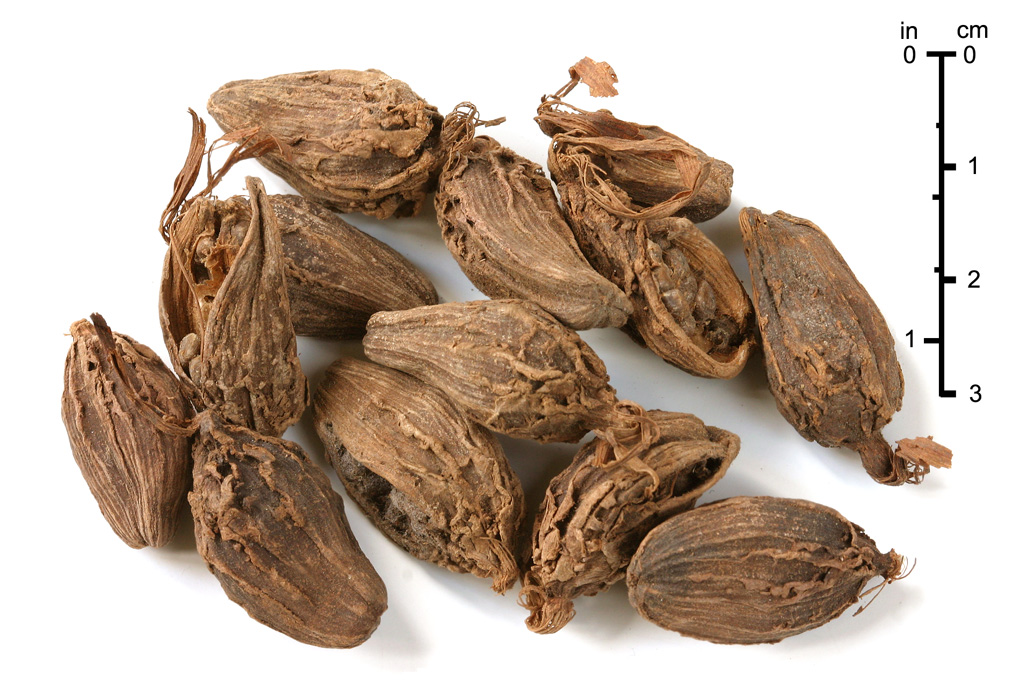
Below the high road lies a quieter district that many people drive straight through. Aritar has a long lake, a dak bungalow built in 1895 and family homestays. Mankhim hill holds a temple of the Kirat Rai. Rolep, Lingtam and Padamchen are farming villages along the rivers, and Rhenock, Rorathang and Rangpo are market towns where large cardamom, ginger and broom grass change hands in season. Pakyong town, the headquarters, sits below Sikkim's only airport, which has had no scheduled flights since June 2024.
The district climbs from about 330 m at Rangpo to around 4,000 m near Kupup within roughly 100 km of road, so plan the altitude the way you would plan North Sikkim: one night low at Aritar, Rolep or Lingtam, then Padamchen or Zuluk, then Nathang. Beyond Rongli you need a Silk Route permit, and only Indian nationals may go. Foreign friends can share the lower villages with you. Check current status before you travel.
Highlights
What brings people here
The Zuluk loops at sunrise
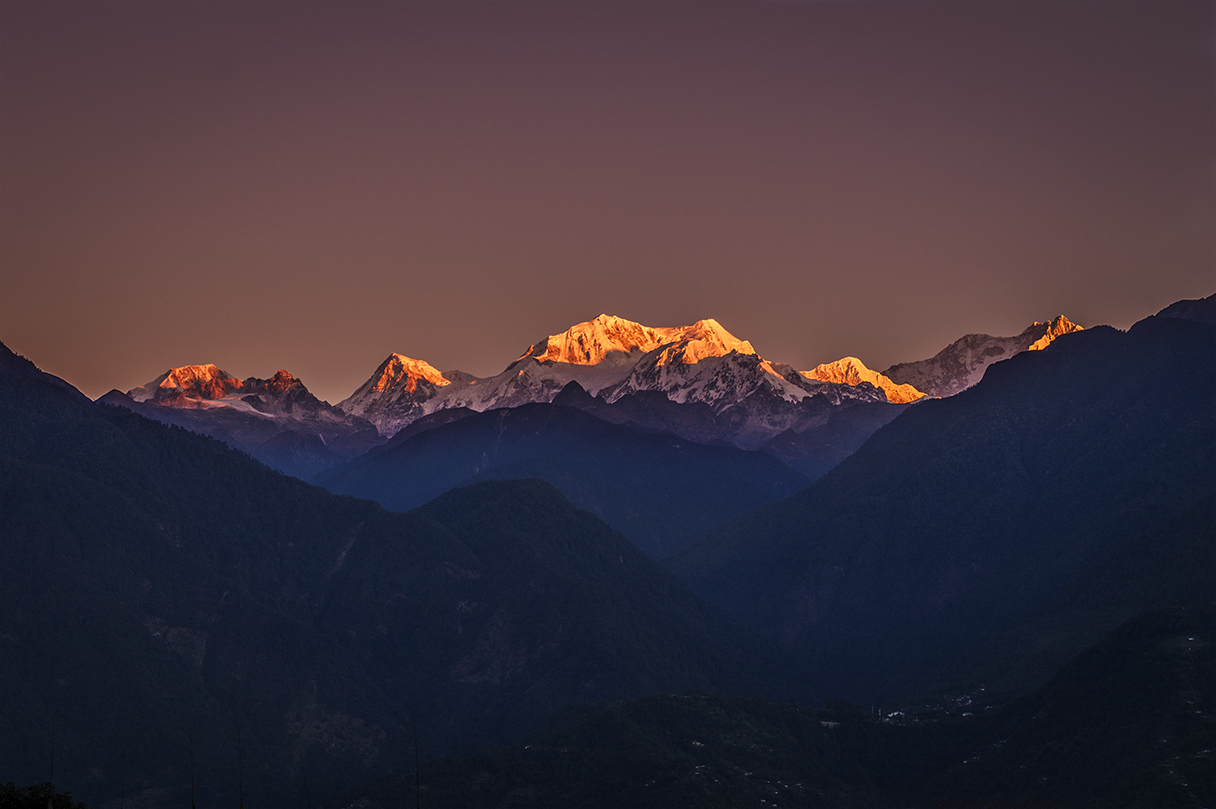
From Zuluk at about 2,800 m, a 30–40 minute pre-dawn drive takes you to Thambi View Point at about 3,400 m. On clear mornings from October to March the Kangchenjunga range lights up to the west and the hairpin road appears below you. Indian nationals only.
Nathang Valley and Kupup
A wide high valley at about 3,750 m with yak herders, a small gumpa and a memorial to the 1888 fighting at Gnathong. Above it, Kupup and the Jelep La ridge reach close to 4,000 m. Visit after a night at Zuluk, never on your first day.
Aritar and Lampokhari lake
A long natural lake at about 1,450 m with paddle boats, a lakeside path, an 1895 dak bungalow and a Kagyu gumpa. Aritar needs no special permit, so it is where mixed groups with foreign friends can stay together.
Mankhim hill and the Kirat Rai temple
A 30-minute drive above Aritar, at about 1,980 m, the Mangkhim temple of the Rai community looks out over the Rangpo valley. Sunrise views of the snow peaks on clear mornings, and the Sakewa festival dances in spring.
River villages: Rolep and Lingtam
Farming hamlets at about 1,200–1,400 m along the upper Rangpo river and the Rongli river, with family homestays, terraced fields and riverbank walks. The best first or last night of a Silk Route trip, and a slow trip of their own.
Padamchen forest and the Pangolakha sanctuary
Padamchen, at about 2,200 m, sits in the mixed forest of the Pangolakha Wildlife Sanctuary. Spring rhododendrons, laughingthrushes and minlas at dawn, and a gentle acclimatisation night before Zuluk and Nathang.
A rooted story
The wool road to Kalimpong and the 1888 campaign
The trade path through Pakyong district was once the busiest link between Tibet and British India. Wikipedia's article on Jelep La describes the Kalimpong route over the pass as the one that boosted local economies through the trade in wool and furs, passing Rongli, Rhenock, Pedong and Algarah. Its strategic value made it a battlefield. In 1886 Tibetan troops crossed Jelep La and built a fort and gate at Lingtu, on the ridge above Zuluk, about 21 km inside Sikkim. Britain sent an ultimatum to withdraw by 15 March 1888. In January that year, according to Wikipedia's account of the Sikkim expedition, the 32nd Pioneers were sent ahead to repair the Rongli bridge and the road. Brigadier-General Thomas Graham's column then marched up from Pedong, and a detachment of 200 men was posted at Pakyong. On 20 March Graham's men carried the Tibetan stockade at Jeluk, the old spelling of Zuluk, and the next day took the Lingtu fort. A larger Tibetan attack on the British camp at Gnathong, today's Nathang, was beaten off in May. The 1890 Convention of Calcutta then fixed the Sikkim–Tibet boundary. Trade flowed again, and John Claude White, Sikkim's first Political Officer, built a dak bungalow at Aritar in 1895. When you drive from Rongli up to Nathang, you follow the line of that campaign almost bend for bend.
Fly to Bagdogra (IXB) or take a train to New Jalpaiguri (NJP). Pakyong Airport has had no scheduled flights since June 2024. From NJP the usual road follows NH10 up the Teesta to Rangpo, about 90 km and 3–3.5 hours, then climbs via Rorathang to Rongli, about 110 km and 4–4.5 hours in all. NH10 closes after monsoon slides; the alternative is via Kalimpong, Pedong and Reshi into Rhenock, which follows the old trade road. From Gangtok, Rongli is about 65 km and 2.5–3 hours via Ranipool, Pakyong and Rorathang. Shared jeeps run from Gangtok and Siliguri to Rongli, Rhenock and Rangpo. Beyond Rongli you need a permit-registered vehicle. The Sevoke–Rangpo railway is not open yet; completion is targeted for December 2027. Check current status before you travel.
The upper Silk Route beyond Rongli, including Lingtam, Padamchen, Zuluk, Thambi View Point, Nathang and Kupup, is a protected area open to Indian nationals only. The permit is processed at Rongli for named people, dates and a vehicle, usually through a registered agent, driver or homestay; carry original photo ID, copies and two passport photos. Foreign nationals, including OCI holders, are not allowed beyond Rongli, but Aritar, Mankhim, Rhenock, Rorathang, Rangpo and Pakyong town need only the general Sikkim entry permit. For Rolep, ask us. Check current status before you travel.
On a budget, two people sharing a reserved car from NJP for a 3-night Silk Route loop with homestays and meals should plan on about ₹9,000–12,000 each, including permits. Homestays across the district run at about ₹1,200–2,000 per person a night with dinner and breakfast, and a shared jeep seat from Gangtok to Rongli costs about ₹200–300. A value trip with a private SUV and the better Aritar and Padamchen houses comes to about ₹20,000–28,000 per person for 5 nights. Comfort travellers can add nights at Vivanta Sikkim in Pakyong, at about ₹9,000–16,000 a room. All prices are indicative.
Silk Route permit via RongliZuluk
≈ ₹200–500 per person through an agent
Homestay with all mealsZuluk
≈ ₹1,200–1,800 per person a night
Shared jeep Gangtok to RhenockAritar
≈ ₹250–400 a seat
Homestay with mealsAritar
≈ ₹1,500–2,500 per person a night
Silk Route permit via RongliNathang Valley
≈ ₹200–500 per person through an agent
Homestay with all mealsNathang Valley
≈ ₹1,300–2,000 per person a night
Silk Route permit via RongliPadamchen
≈ ₹200–500 per person through an agent
Homestay with dinner and breakfastPadamchen
≈ ₹1,200–1,800 per person a night
Homestay with mealsRolep
≈ ₹1,300–2,000 per person a night
Reserved small car from GangtokRolep
≈ ₹4,000–5,500 one way
Indicative 2026 prices. Fares, fees and room rates change with season: check current status before you travel.
Is Pakyong district the same as the Old Silk Route?
Mostly. The district includes the Sikkim stretch of the old Kalimpong–Tibet trade road, from Rhenock and Rongli up through Zuluk and Nathang towards Jelep La. Kupup itself falls in Gangtok district. Pakyong district also covers Pakyong town, Rangpo, Rorathang and quiet villages like Aritar and Rolep that most Silk Route trips pass through.
Can foreigners visit the Silk Route?
No. Foreign nationals, including OCI holders, are not allowed beyond Rongli, so Zuluk, Thambi View Point, Nathang and Kupup are closed to them. They can stay at Aritar, Mankhim, Rhenock and Pakyong town with the general Sikkim entry permit applied for online on the e-FRRO portal. Rules change, so check current status before you travel.
Are there flights to Pakyong Airport?
Not at present. Pakyong Airport has had no scheduled flights since June 2024. Plan your trip on Bagdogra (IXB), about 115–125 km and 4.5–5 hours from Rongli, or New Jalpaiguri (NJP) railway station, about 110 km and 4–4.5 hours. If flights resume we will update this page, but check current status before you travel.
How many days do I need for Pakyong and the Silk Route?
Three nights is the minimum for a loop from Gangtok to Zuluk and Nathang. We prefer four or five nights from NJP or Bagdogra: Aritar or Lingtam first, then Padamchen or Zuluk, then Nathang or a second Zuluk night, and back via Rongli or, when open, via Kupup and Tsomgo to Gangtok.
What is the best time to visit the Silk Route?
October to December for clear mountain views, and March to May for rhododendrons. January and February bring snow but frequent road closures. Avoid mid-June to mid-September, when monsoon slides cut NH10 and the Rongli–Zuluk road and clouds hide the peaks. The lower villages such as Aritar are pleasant all year. Check current status before you travel.
Is altitude sickness a problem on the Silk Route?
It can be, because the road climbs from about 830 m at Rongli to about 3,750 m at Nathang in a few hours. Sleep the first night low at Aritar, Lingtam or Rolep, then Padamchen or Zuluk, and only then go to Nathang. Drink water, avoid alcohol on the first high night, and descend if headaches worsen.
Where do I get the Silk Route permit?
At Rongli, the subdivision town at the foot of the high road. Your driver, agent or homestay usually files it from scans of your photo ID, and you collect it on the way up. Carry originals, photocopies and two passport photos. The government fee is about ₹200 per person, plus handling. Check current status before you travel.
Can we do the Silk Route by shared jeep?
Only part of it. Shared jeeps run from Gangtok and Siliguri to Rongli and Rhenock for about ₹200–400 a seat. Above Rongli, local jeeps serve residents once or twice a day, and above Zuluk there is no shared transport. In practice you need a reserved, permit-registered car for the high road, which a group can share.
Is there mobile network and ATMs in Pakyong district?
Pakyong, Rangpo, Rorathang, Rhenock and Rongli have ATMs and decent mobile coverage. Above Rongli there are no ATMs, and signal is patchy at Zuluk and weak at Nathang. Withdraw cash at Rhenock or Rongli, download offline maps, and tell your family you may be out of touch for a night.
Little known
Things most visitors to Pakyong and the Silk Route never hear
Each one is sourced, so you can check it yourself.
Pakyong's name is usually explained from the Lepcha pa yong, meaning bamboo of the bow, following the Lepcha habit of naming a place after something useful that grew there.
Source: Wikipedia: Pakyong
Pakyong Airport sits at about 1,416 m on a ridge built up with embankments, one of them around 263 ft high. It opened in 2018, but has had no scheduled flights since June 2024.
Source: Wikipedia: Pakyong Airport (check current status before you travel)
The Rangpo river, Sikkim's third largest after the Teesta and Rangeet, rises at Menmecho Lake below Jelep La and runs past Rolep, Rongli and Rorathang to meet the Teesta at Rangpo.
Source: Wikipedia: Rangpo River; Wikipedia: Lake Menmecho
Pangolakha Wildlife Sanctuary, set up in 2002 over about 124 km² between roughly 1,760 m and 4,390 m, has eco-development committees in Mankhim, Dalapchand, Lingtam, Padamchen, Zuluk and Gnathang.
Source: Wikipedia: Pangolakha Wildlife Sanctuary
Wikipedia records that Sikkim's first police outpost began work at Aritar in 1897, on the premises of the 1895 dak bungalow, where the state's first treasury was also set up.
Source: Wikipedia: Aritar, Sikkim; Wikipedia: John Claude White
One person to callFrom Bagdogra or NJP until you are back
No payment to startA deposit only when you book
Get my price
Plan Pakyong and the Silk Route with people who live here
Who is travelling, when, and roughly what you want to spend. The Gangtok desk replies within one working day with a day-by-day plan and an itemised price.
No payment to start
Permits handled through registered partners
Every hotel, car and fee listed
Price my Sikkim trip
Tell us dates, people and budget. You get a day-by-day plan and an itemised price within one working day.